

Spatial and temporal analysis of Dead Sea Transform historical earthquakes
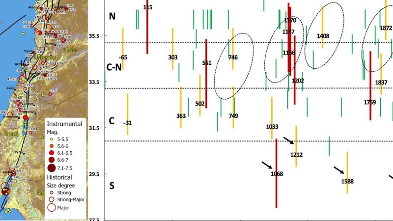
This project investigated the long-term seismic history of the Dead Sea Transform (DST) by integrating historical documentary sources, archaeoseismological evidence, and paleoseismic records within a GIS-based analytical framework. The research addressed the limited temporal coverage of instrumental seismic observations by reconstructing approximately 3,000 years of historical earthquake activity across the Levant.
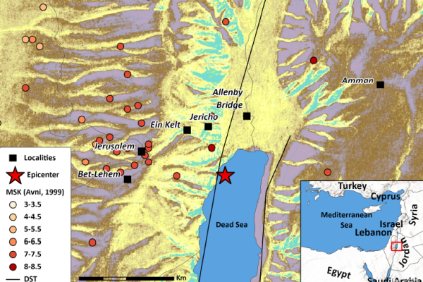
A standardized geospatial database of historical earthquake damage was developed, and the EMS-98 intensity scale was adapted for historical construction practices to enable consistent intensity assessment. The resulting database supported the analysis of spatial and temporal patterns of historical seismicity, cumulative earthquake damage, and the characterization of seismic activity throughout the Dead Sea Transform system.
The project also improved understanding of regional seismic hazards by identifying recurring patterns of earthquake impacts, evaluating the vulnerability of historically important settlements, and providing an open GIS-based dataset to support future research, hazard assessment, and disaster-risk management.
The research was conducted with Prof. Amos Salamon, the Geological Survey of Israel.
Funded by the Ministry of Energy
Publications
Zohar, M., Salamon, A., Rapaport, C., (2023). How Expert Is the Crowd? Insights into Crowd Opinions on the Severity of Earthquake Damage. Data 2023, 8 (6), 108. DOI: https://doi.org/10.3390/data8060108
Zohar M. (2020). Temporal and spatial patterns of seismic activity associated with the Dead Sea Transform (DST) during the past 3000 yr. Seismological Research Letters. DOI: https://doi.org/10.1785/0220190124.
Additional Material
- Zohar, M., Salamon, A., Arad A. (2019). Damage descriptions of historical earthquakes along the Dead Sea Transform and preliminary conversion to the EMS-98 intensity degrees. Final report to the Ministry of Energy, Report ES-19-19, pp. 23
- Zohar, M (2018). 3D GIS for reconstructing damage in Tiberias after the 1837 earthquake. National Knowledge and Research Center for Emergency Readiness, University of Haifa Poster