
This study investigates the catastrophic flooding that struck Tiberias, Israel, on May 14, 1934, a rare and highly destructive event in the city’s modern history. Situated along the western shore of the Sea of Galilee, Tiberias has long been exposed to natural hazards, notably earthquakes and flash floods. The 1934 flood, triggered by an exceptional 52 mm rainfall within a single day, caused severe damage to life, property, and the urban fabric, marking a turning point in the city’s development. While previous research has described the disaster’s social and physical impacts, significant gaps remain regarding its quantitative hydrological characteristics, the extent of its geomorphological consequences, and its role in shaping subsequent urban restructuring.
The primary goals of this research are fourfold. First, to reconstruct the hydrometeorological conditions of the event through historical meteorological records, archival photographs, maps, and contemporary press accounts, including underutilized British administrative sources. Second, to assess the magnitude and pathways of floodwater and sediment flow into the city using a GIS-based methodology that integrates historical cartography, high-resolution terrain models (DEM/DSM), and hydrological modeling. Third, to evaluate the flood’s contribution to significant changes in Tiberias’s urban layout, such as the creation of new east–west streets, demolition of waterfront housing, and construction of protective infrastructure along the lakefront. Fourth, to compare the 1934 flood with earlier and later catastrophic events—most notably the 1837 earthquake and the November 1934 flood—to identify patterns of urban adaptation to recurring natural hazards.
The study employs a multidisciplinary methodology combining historical geography, urban morphology, and environmental modeling. Digitization and georeferencing of pre- and post-flood maps allow for detailed three-dimensional reconstruction of the urban landscape before and after the disaster. Hydrological simulations, based on period-specific rainfall and runoff data, provide estimates of water volumes, flow velocities, and sediment loads. This approach enables both a qualitative and quantitative reconstruction of the event’s dynamics and consequences.
By integrating historical narratives with advanced geospatial analysis, this research not only deepens the understanding of the 1934 Tiberias flood but also contributes to broader discussions on disaster-driven urban change. The findings offer valuable insights into the long-term resilience and vulnerability of cities situated in hazard-prone environments and present methodological tools for reconstructing and interpreting past catastrophic events to inform contemporary disaster preparedness.
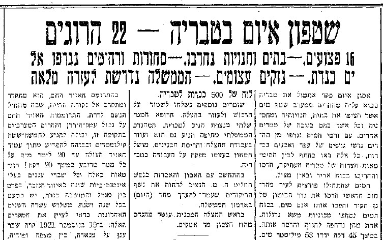
Below: A newspaper article publish in ‘Davar’, 15.05.1934