

Natural Hazards

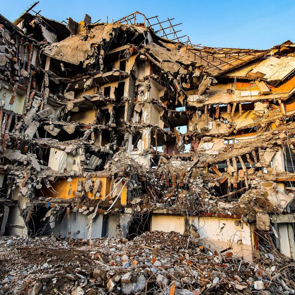
This course explores the physical processes behind major natural hazards and their impacts on human societies and the environment. Topics include earthquakes, floods, landslides and other geophysical and environmental hazards, with attention to both historical events and contemporary risk. The course combines scientific understanding of hazardous processes with approaches to risk assessment, mitigation and disaster preparedness.

Course at a Glance

Focus: Natural hazards and their impacts on society
Approach: Physical processes, historical evidence and risk assessment
Geographic Scope: Global, with selected regional case studies
Key Themes: Earthquakes, tsunamis, volcanic eruptions, floods, landslides, climate hazards, mitigation, preparedness

Why Natural Hazards?

Natural hazards have shaped landscapes and human societies throughout history and continue to pose major challenges today. Understanding how these processes occur, how we reconstruct past events and how societies can prepare for future hazards provides an essential foundation for assessing risk and reducing their impacts.

Course Objectives

  • Introduction to natural and environmental hazards and the physical processes that lead to their formation
  • Understand how and in what ways natural hazards have affected human environments in the past and continue to affect them today
  • Examine how we know about natural hazards that occurred in the past and the sources of information used to reconstruct them
  • Explore current and future approaches to coping with natural hazards

View / Download Syllabus →

Course Content

Explore the major processes, case studies, and approaches used to understand natural hazards and their impacts on society and the environment:

Lesson 1: Introduction to natural hazards

Introduction to the course, the study framework, and basic concepts. We will discuss the main energy sources that drive natural processes on Earth and the connection between them and human systems.

Bibliography:

  • Abbott, P. L. (2008). Natural Disasters. New York: McGraw-Hill. Chapters 1-2
  • Marsh, W. M., & Kaufman, M. M. (2013). Physical Geography: Great Systems and Global Environments. Cambridge University Press. Chapter 3

Lesson 2: How do we know? Characteristics of natural hazards

This session deals with methods for characterizing and reconstructing natural hazards that occurred in the past, while presenting geological, geomorphological, and historical sources of information. Their advantages and limitations will be discussed, as well as issues of uncertainty, temporal and spatial scales, and biases in the record.

Bibliography:

  • Marco, S. (2008). Recognition of earthquake-related damage in archaeological sites: Examples from the Dead Sea fault zone. Tectonophysics, 453(1-4), 148-156.
  • Zohar, M., Rubin, R., & Salamon, A. (2014). Earthquake damage and repair: New evidence from Jerusalem on the 1927 Jericho earthquake. Seismological Research Letters, 85(4), 912-922.
  • Bookman, R., Enzel, Y., Agnon, A., & Stein, M. (2004). Late Holocene lake levels of the Dead Sea. Geological Society of America Bulletin, 116(5-6), 555-571.

Lesson 3: Earth’s structure and plate tectonics

The structure of the Earth and the principles of plate tectonics as a basis for understanding tectonic hazards. The types of plate boundaries, the internal energy sources of the Earth, and the relationship between plate motion and the generation of earthquakes and tsunamis will be discussed. The lesson provides a physical foundation for understanding the hazard mechanisms that will be addressed in subsequent sessions.

Bibliography:

  • Press, F., & Siever, R. (2004). Understanding Earth. New York: W. H. Freeman. Chapter 4-6.
  • Abbott, P. L. (2008). Natural Disasters. New York: McGraw-Hill. Chapter 3

Lesson 4: Earthquakes, damage & environmental effects

The mechanism of earthquake generation and the release of seismic energy. The session will discuss the different types of seismic waves, methods for measuring and characterizing earthquakes, and the relationship between earthquake characteristics and patterns of damage and vulnerability. It will also examine the geological, engineering, and social factors that influence the extent of damage in earthquake events.

Bibliography:

  • Abbott, P. L. (2008). Natural Disasters. New York: McGraw-Hill. Chapter 4

Lesson 5: Tsunamies and sea waves

The geophysical mechanisms responsible for tsunami generation, with an emphasis on submarine earthquakes, slope failures, and volcanic eruptions. The session will discuss the processes governing tsunami wave propagation in the open ocean and their amplification in coastal areas, as well as the relationship between wave characteristics, coastal topography, and patterns of vulnerability.

Bibliography:

  • Abbott, P. L. (2008). Natural Disasters. New York: McGraw-Hill. Chapter 5

Lesson 6: Case study – the 1906 California earthquake

The 1906 San Francisco earthquake as an integrative case study for tectonic risk analysis. The seismic mechanism, patterns of damage and fires, as well as the social, economic, and planning implications of the event, will be examined as a basis for understanding earthquake risk management.

Bibliography:

  • Zoback, M. L. (2006). The 1906 earthquake and a century of progress in Understanding Earthquakes and their hazards. GSA Today, 16(4/5), 4.
  • Odell, K. A., & Weidenmier, M. D. (2004). Real shock, monetary aftershock: The 1906 San Francisco earthquake and the panic of 1907. The Journal of Economic History, 64(4), 1002–1027.

Lesson 7: Volcanic eruptions

Volcanic structures and magmatic processes underlying volcanic activity. The principal sources of hazard in volcanic eruptions will be discussed, including lava flows, ash fall, pyroclastic flows, and gases, as well as their relationship to different types of volcanoes and tectonic settings.

Bibliography:

  • Abbott, P. L. (2008). Natural Disasters. New York: McGraw-Hill. Chapter 6-7.
  • Press, F., & Siever, R. (2004). Understanding Earth. New York: W. H. Freeman. Chapter 7.

Lesson 8: Floods mechanisms and formation

The hydrological and geomorphological mechanisms underlying flood generation, with an emphasis on extreme events in arid and semi-arid regions. Climatic, topographic, and land-use factors affecting flood intensity will be discussed, with a focus on Israel as a case study.

Biblyography:

  • Greenbaum, N., Schick, A. P., & Baker, V. R. (2000). The palaeoflood record of a hyperarid catchment, Nahal Zin, Negev Desert, Israel. Earth Surface Processes and Landforms, 25(9), 951-971

Lesson 9: Landslides and morphodynamics – Mass movement processes

Mass movement processes and slope failures as a product of the interaction between topography, geology, water, and human activity. Different types of landslides, triggering factors, and the relationship between morphodynamic processes and risks to infrastructure and settlements will be discussed.

Biblyography:

  • Press, F., & Siever, R. (2004). Understanding Earth. New York: W. H. Freeman. Chapter 16
  • Abbott, P. L. (2008). Natural Disasters. New York: McGraw-Hill. Chapter 6.

Lesson 10: Climate & weather hazards

Extreme weather phenomena such as heatwaves, heavy rainfall events, droughts, and storms, and their connection to contemporary climate change. Climatic mechanisms, observational trends, and the intensification of natural hazards across space and time will be discussed, alongside their social and health impacts.

Bibliography:

  • Abbott, P. L. (2008). Natural Disasters. New York: McGraw-Hill. Chapter 10
  • Marsh, W. M., & Kaufman, M. M. (2013). Physical Geography: Great Systems and Global Environments. Cambridge University Press. Chapter 8
  • Press, F., & Siever, R. (2004). Understanding Earth. New York: W. H. Freeman. Chapter 15

Lesson 11: Course summary – what does the future hold for us?

Field Campus: Southern Gaililee & Tiberias

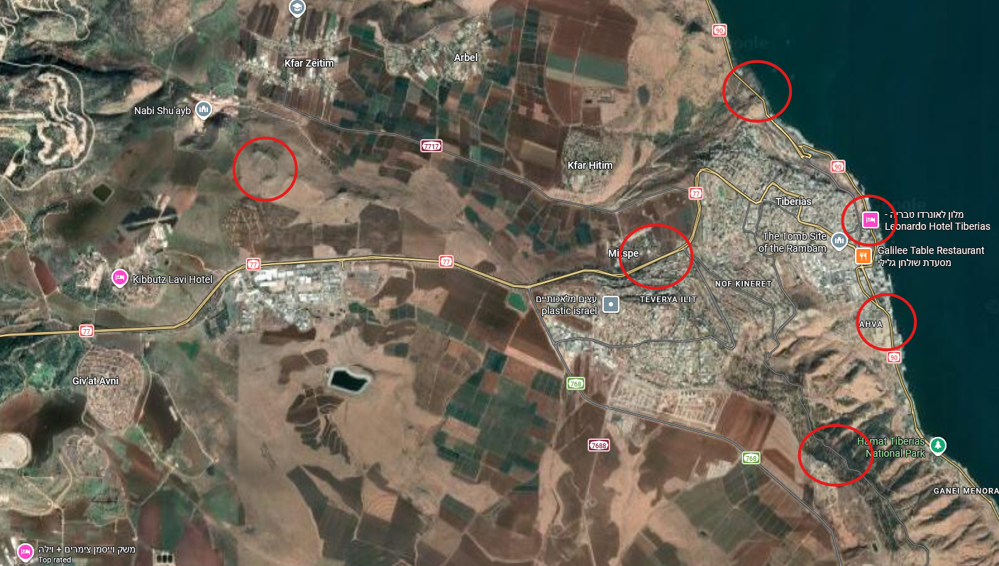
Final field trip: focuses on the identification and analysis of natural and environmental hazards in the field through the application of the concepts and tools learned in the course. During the field trip, tectonic, geomorphological, and hydrological processes in the southern Galilee and the Sea of Galilee region will be examined, alongside their impact on infrastructure, settlement, and resource management.
Tools & Technologies

The course combines scientific, historical, and spatial approaches to the study of natural hazards. Students work with maps, geological and environmental data, historical records, scientific literature and digital resources to investigate past and present hazard events. Artificial Intelligence (AI) tools as well as GIS-based mapping and spatial visualization are used where relevant to examine hazard distribution, impacts, and relationships between physical processes and human environments.