
Students & Supervision
Ph.D. Students
Adi Ophir
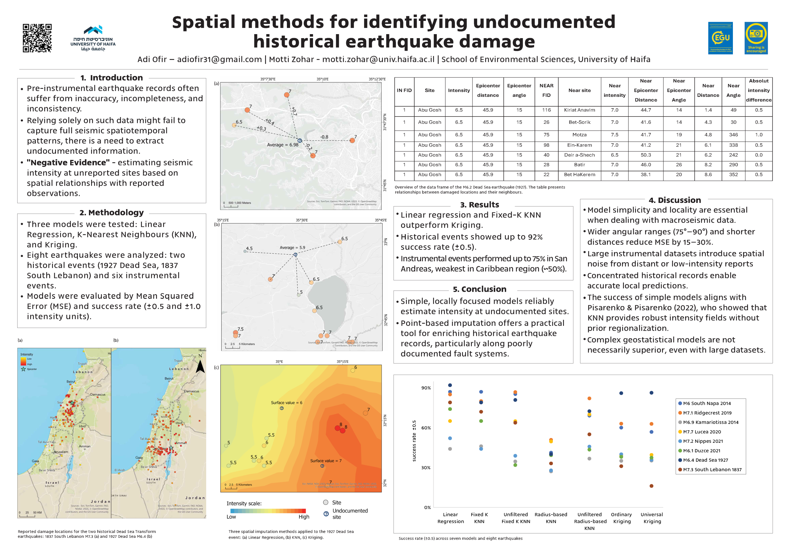
>> Analysis of spatiotemporal patterns of seismic activity associated with the Dead Sea Transform
Jefferson Williams
>> Reconstructing southern Dead Sea Transform first-millennium CE seismic activity using an integrated historical, archaeoseismic, and paleoseismic data spatial analysis approach
– Co-supervised with Beverly Goodman-Tchernov
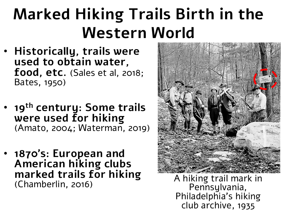
Aviv Oppenheim
>> The development of marked hiking trails in Palestine/Israel, 1858 – 1995
– Co-supervised with Asaf Selzer
Noa Shamir
>> Spatial distribution of contaminants in the cities of Haifa and Beér Sheva and their surrounds
– Co-supervised with Alon Lotan and David Broday
Master’s Students
Efrat Kerem
>> Studying the morphology’s data of which it expressed in maps between 13th-18th centuries in the Dead Sea using GIS mapping
– Co-supervised with Revital Bookman
Pablo Heller
>> Spatial analysis of paleofloods in the Negev desert
– Co-supervised with Noam Greenbaum
Post-Doctoral Fellows
Subham Mukherjee
>> Comparative analyses of freshwater ecosystem services and adaptation strategies towards a sustainable water-secured future for coastal urban areas [2023]
– Co-supervised with Eran Feitelson & Brigitta Schutt
Graduate Alumni
Neta Yalon [2021]
>> Do stone mounds (Tulilat El Anab) affect soil moisture in their environment? The slopes around Shivta as a case study
– Co-supervised with Dan Malkinson
Lian Kombelis [2022]
>> A GIS-based spatial analysis of damage patterns – potential earthquakes at the Byzantine village of Shivta
– Co-supervised with Yotam Tepper
Almog Arad [2023]
>> Historical earthquakes damage in long inhabited cities in Israel
Liat David [2023]
>> GIScience and computer vision for the analysis of old drawings
– Co-supervised with Ilan Shimshoni
Amichai Sade [2023]
>> The analysis of Shiniyot in the Negev
– Co-supervised with Tali Erickson-Gini
Tom Avikasis [2024]
>> Gardens in Mandatory Jerusalem using GIScience & machine learning
– Co-supervised with Ilan Shimshoni
Olivia Ayres [2024]
>> Look Up, Look Out, Look All Around: Lookouts and Landmarks in Greek and Roman Mediterranean
– Co-supervised with Emmanuel Nantet
Lior Svirsky [2024]
>> GIScience methodologies to map the moon craters
Yulia Mazor-Verbizky [2025]
>> Decoding water management strategies: unveiling spatial patterns of the mounds in the Shivta region through geospatial analysis
Erel Uziel [2025]
>> Semi-Automated Detection of Building Stones Using High Resolution Imagery
– Co-supervised with Yitzhak Jaffe
Bobby Katrivanos [2025]
>> Developing visualization of harbors in antiquit
– Co-supervised with Emmanuel Nantet
Selected Work