

Using Twitter for near real-time alerts and damage analysis of natural hazards
This project investigated the use Twitter as a source of near real-time information during natural hazard events. By integrating geospatial analysis with social media analytics, the research examined how user-generated content could support rapid damage assessment and situational awareness following floods, wildfires, and earthquakes in Israel and the United States.
Spatial and temporal analyses of georeferenced tweets were conducted to identify affected areas, evaluate damage patterns, and assess the potential of social media as a complementary source of disaster information. The project also explored how these data could improve the validation of preliminary damage assessments and support emergency management during the critical early stages of natural disasters.
Funded by the National Knowledge and Research Center for Emergency Readiness & the Ministry of Science and Technology
The research was conducted with Prof. Avi Gal, Faculty of Industrial Engineering & Management , Technion.

Publications
Zohar M. (2021). Geolocating tweets in Israel via spatial inspection of information inferred from tweet meta-fields. International Journal of Applied Earth Observation and Geoinformation. DOI: https://doi.org/10.1016/j.jag.2021.102593.
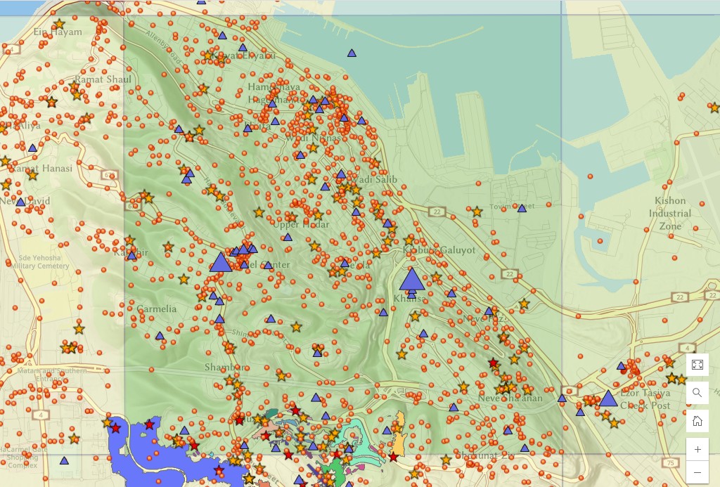
Zohar, M., Gennosar, B., Avny, R., Tessler, N. Gal, A., (2023). Spatiotemporal analysis in high resolution of tweets associated with the November 2016 wildfire in Haifa (Israel). International Journal of Disaster Risk Reduction. DOI: https://doi.org/10.1016/j.ijdrr.2023.103720
- Zohar, M., Genossar, B., Avny, R., Tessler, N., Gal, A. (2025). Leveraging OpenStreetMap for hyperlocal geocoding of Twitter data: A spatiotemporal analysis of the 2016 Haifa (Israel) wildfire. Proceedings of the OSMScience 2025, Oct 2025, Manila, Philippines Pdf
Additional Material
Gal, A., Genossar, B., Zohar, M. (2020). Natural disasters in Israel and USA as documented in the social media of Twitter. Final report to the National Knowledge and Research Center for Emergency Readiness, pp. 23 Pdf
Zohar, M., Gennosar, B., Avny, R., Tessler, N. Gal, A., (2024). Spatiotemporal distribution of tweets associated with the fire in Haifa (Israel), November 2016, ESRI Map Book, Volume 39
Zohar, M., Gennosar, B., Avny, R., Tessler, N. Gal, A., (2023) Spatial analysis of Wildfire twitter data. Distinguished GIS artwork presented at the plenary session in Esri User Conference, San Diego, USA 2023. Link
Data & Resources
Detecting cascading events during the November 2016 wildfire in Haifa and its close surroundings (link to map)