

Virtualization of Ottoman Palestine using Historical GIS (HGIS) and Machine Learning
This project developed and applied Historical GIS (HGIS) and GeoAI methodologies to reconstruct urban landscapes in late Ottoman Palestine from the nineteenth to the early twentieth centuries. By integrating historical maps, photographs, drawings, and textual sources within a geospatial framework, the research reconstructed key stages in the historical development of Jerusalem and Haifa and examined patterns of urban growth, landscape transformation, and human activity.
The project advanced innovative approaches for interpreting historical visual sources through the integration of machine learning and geospatial analysis, demonstrating how historical cartography and archival imagery can be combined to produce accurate digital reconstructions of past cityscapes. The resulting methodologies contributed to both the historical study of Ottoman Palestine and the broader development of GIScience approaches for historical landscape reconstruction.
The research is funded by the Israeli Science Foundation
It was conducted in collaboration with Prof. Ilan Shimshini, department of Information Systems, University of Haifa.
Publications
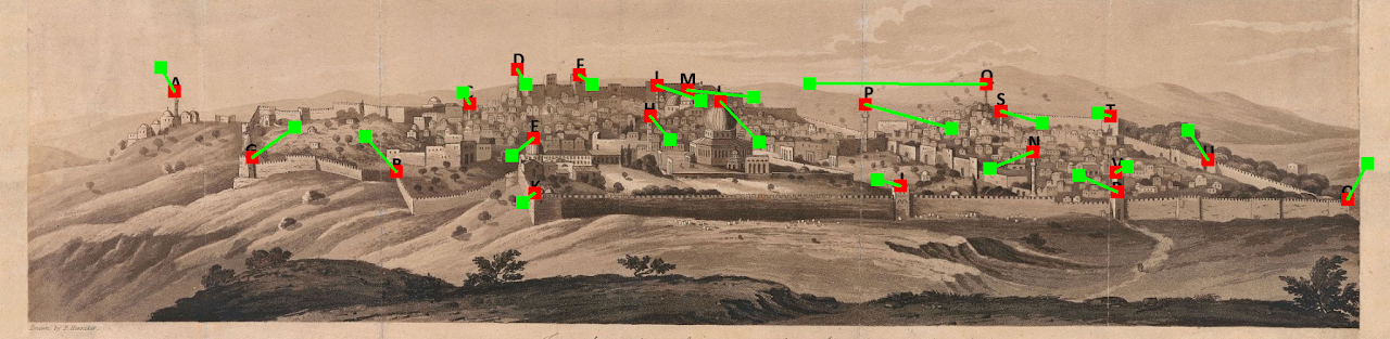
David, L., Zohar, M. and Shimshoni, I., (2023). Geo-referencing Entities Extracted from Old Drawings/Photos Using Computer Vision, Deep Learning and GIScience. ISPRS International Journal of Geo-Information, 12, 500. DOI: https://doi.org/10.3390/ijgi12120500
- Zohar, M. (2022). GIScience and Historical Visual Sources: A Promising Look at Past Scenarios and Sceneries. ISPRS International Journal of Geo-Information, 11(5), 286. https://doi.org/10.3390/ijgi11050286
- Zohar, M. (2022) A land without (a) people? The GIScience approach to estimating the mid-19th-century population of Ottoman Palestine. Applied Geography 141. DOI: https://doi.org/10.1016/j.apgeog.2022.102672
Zohar M., Shimshoni I. (2021). GIScience integrated with computer vision for the examination of old engravings and drawings. International Journal of Geographical Information Science. DOI: https://doi.org10.1080/13658816.2021.1874957
Zohar, M., Shimshoni, I., & Khateb, F. (2020). GIScience Integrated with Computer Vision for the Interpretation and Analysis of Old Paintings. In Proceedings of the 6th International Conference on Geographical Information Systems Theory, Applications and Management – Volume 1 (233-239): GISTAM, Prague, Czech Republic. DOI: https://doi.org/10.5220/0009464902330239
Additional Material
- Zohar, M. (2024). A new look at urban and human activity in Late Ottoman Palestine: Virtualization of Jerusalem and Haifa using Historical GIS (HGIS) and Machine Learning. Final report submitted to the Israel Science Foundation (ISF), pp. 9. Pdf
Data & Resources
A land without people? population estimation of Late Ottoman Palestine using GIScience approach (link to story map)
Github [Zohar M., Shimshoni I. (2021)]: https://github.com/zoharmot2/GIScience-CV-old-drawings
Zenodo [Zohar M., Shimshoni I. (2021)]: https://zenodo.org/record/7003906#.Yv0fmhxByUk